


DJI Matrice 4E | Mechanical Shutter Ultimate Mappers Kit
- Regular price
-
$4,999.00 USD - Regular price
-
- Sale price
-
$4,999.00 USD
Delivers in 5-7 Business Days
Net 30 Available for Agencies
Protection Coverage Available at Checkout
Couldn't load pickup availability


Ready To Fast Track Your Start-Up
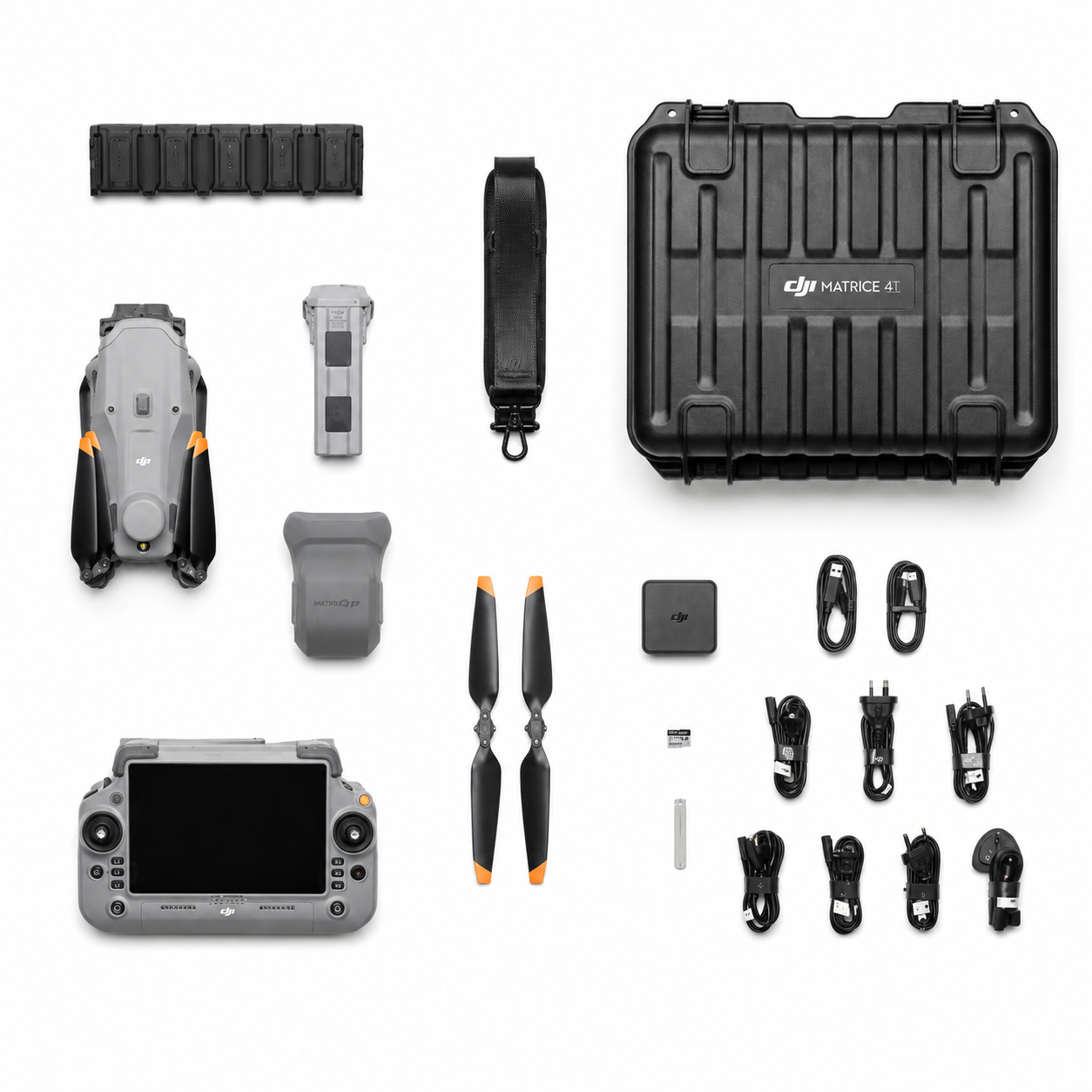
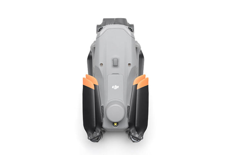
The DJI Matrice 4E is the mapping and photogrammetry drone in DJI's enterprise lineup. 4/3-inch CMOS wide-angle camera with mechanical shutter for geometrically clean output at full mapping speed. Three optical cameras plus a laser rangefinder. Integrated RTK module. Up to 49 minutes of flight time per battery.
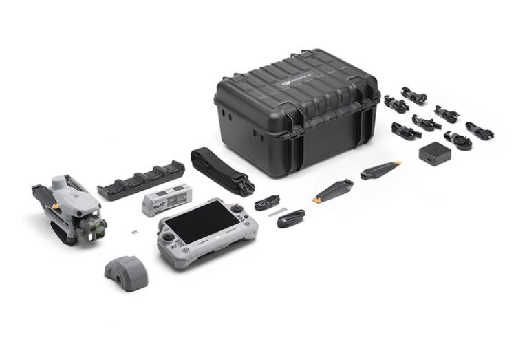
This is the standalone aircraft listing. It includes the drone, RC Plus 2 controller, and accessories needed to fly. It does not include the D-RTK 3 base station, survey pole and tripod, additional batteries, or DJI Terra license.
For a complete turnkey survey system with the D-RTK 3 base station, survey pole, 4 batteries, and a 1-year Terra license bundled at a lower total cost, see the M4E Precision Mapping & Surveying Bundle. The standalone M4E listed here is for operators who already own RTK infrastructure, plan to use network RTK (NTRIP), or are building a custom configuration.
Real people answer the phone at (863) 224-6923. No hold queue, no offshore call center.
Standard delivery is 5 to 7 business days.
Quick Facts
- Built for: Licensed surveyors, civil engineers, construction operators, GIS professionals (standalone aircraft)
- Wide Camera: 4/3" CMOS with mechanical shutter, 20MP
- Total Cameras: 5 sensors (wide + medium telephoto + telephoto + laser rangefinder + AI detection)
- RTK Module: Integrated, compatible with D-RTK 3 base station, NTRIP, and PPK workflows
- Mapping Speed: Up to 21 m/s with mechanical shutter
- Flight Time: Up to 49 minutes per battery (1 battery included)
- Oblique Capture: 5-directional in a single pass
- Coverage: Up to 2.8 km² per flight at standard altitude
- Delivery: 5 to 7 business days
- Coverage: CPS Drone Protection available at checkout
Standalone M4E or Mapping Bundle?
This is the aircraft only. The right choice depends on what infrastructure you already have:
| If you... | Choose |
|---|---|
| Already own an RTK base station or use network RTK (NTRIP) | Standalone M4E (this listing) |
| Need a complete turnkey survey system from scratch | M4E Mapping & Surveying Bundle |
| Operate in areas with reliable cellular coverage | Standalone M4E (this listing) with NTRIP subscription |
| Operate in rural corridors or remote terrain | M4E Mapping & Surveying Bundle with D-RTK 3 base station |
| Want the included 1-year DJI Terra license | M4E Mapping & Surveying Bundle |
| Already have a Terra license from a previous DJI purchase | Standalone M4E (this listing) |
Not sure which fits your operation? Call us at (863) 224-6923. We'll talk through your current setup before you commit.
Why the Matrice 4E for Mapping
Mechanical Shutter
The single most important feature on the M4E for photogrammetry work is the mechanical shutter on the wide-angle camera. Electronic shutters expose each row of the sensor sequentially rather than capturing the entire frame simultaneously. At mapping speeds of 15 to 21 m/s, that sequential exposure creates geometric distortion across the image. Straight lines appear curved, buildings lean, and the orthomosaic requires significant correction work or produces measurable errors.
The M4E's mechanical shutter exposes all pixels simultaneously regardless of aircraft speed. The output is geometrically clean at full mapping speed, every frame, without post-processing compensation.
4/3-Inch CMOS Sensor
The wide-angle camera uses a 4/3-inch CMOS sensor, significantly larger than the 1/1.3-inch sensor in the M4T or sensors in consumer-grade mapping drones. A larger sensor collects more light per pixel, produces less noise at a given ISO, and resolves finer ground detail at the same altitude.
In practical terms, you can fly higher and still produce ground sample distances that meet survey accuracy requirements, which means more coverage area per battery while maintaining output quality. Paired with a variable aperture from f/2.8 to f/11, the M4E handles high-contrast scenes without blown highlights or crushed shadows.
5-Directional Oblique Capture in One Flight
Most compact drones require separate nadir and oblique flight passes to build a complete 3D model. The M4E's gimbal rotates intelligently during a single automated pass and captures nadir, forward-facing, backward-facing, left, and right oblique frames in one flight.
The result is a complete dataset for high-fidelity 3D building models, façade documentation, and terrain reconstruction without planning and executing a second flight. For urban modeling, heritage documentation, and construction-phase BIM updates, this eliminates a full mobilization from your workflow.
Distortion Correction 2.0 with Factory Calibration
Each M4E wide-angle camera is individually factory-calibrated. The calibration parameters flow into DJI Terra (and select third-party photogrammetry platforms) for reconstruction accuracy that exceeds generic photogrammetry pipelines. Residual distortion is calibrated to less than two pixels across the frame.
RTK Workflow Options
The standalone M4E supports three RTK workflows:
- D-RTK 3 base station (sold separately): Centimeter-accurate corrections broadcast directly to the aircraft, independent of cellular coverage. The right option for rural corridors, remote terrain, and operators who want consistent accuracy regardless of network conditions.
- Network RTK (NTRIP): Cellular-based corrections from regional CORS networks. The right option for operators working in areas with reliable 4G coverage and an existing NTRIP subscription.
- PPK post-processing: Office-based corrections using base station logs and aircraft trajectory data. The right option for operators who prefer post-processing over real-time corrections or who don't have base station hardware on site.
If you're new to RTK workflows or evaluating which is right for your operation, call us. We've helped operators set up all three workflows since 2017.
DJI Terra Compatibility
This standalone listing does not include a DJI Terra license. If you need Terra, three options:
- Purchase the M4E Mapping & Surveying Bundle instead, which includes a 1-year Terra license at no additional charge (approximately $1,400 value)
- Purchase DJI Terra separately through DJI (approximately $1,400 per year for the annual license, perpetual licensing also available)
- Use a third-party photogrammetry platform (Pix4D, Agisoft Metashape, DroneDeploy, Correlator3D, Bentley ContextCapture) which all accept M4E imagery with embedded RTK position and orientation tags
Survey and Mapping Applications
- Topographic mapping and land surveys for engineering design, grading plans, contour mapping, and subdivision layout
- Construction site documentation with pre-construction base surveys, weekly progress orthomosaics, earthwork volumes, and final as-built documentation
- Stockpile volume surveys for quarry, aggregate, mining, and construction operations
- Corridor mapping for road, pipeline, and utility projects spanning multi-kilometer lengths
- 3D building and urban modeling for architectural documentation, BIM input data, and heritage preservation
- Mining and quarry operations with volumetric surveys of extraction areas, benches, and overburden
- Environmental and wetland surveys for vegetation mapping, erosion monitoring, and flood plain topography
-
Infrastructure inspection with mapping overlay for bridge, building, and asset documentation
Shipping and Delivery
Delivery: 5 to 7 business days
Some units ship from U.S. inventory. Some ship direct from our supplier. Same delivery window either way.
If your order is delayed, we'll reach out. No silent backorders.
Tracking sent as soon as your unit ships.
Activation Status and Warranty
We're an independent reseller, not an authorized DJI Enterprise dealer.
What that means:
- Units are unused and unflown
- Zero flight time
- Activated prior to resale
- Bind to your DJI account at setup
- Same firmware, software, and functionality
What's different:
- Not eligible for DJI Enterprise Care
- Not covered under DJI U.S. warranty programs
DJI can still service them as paid repairs
Most of our customers run them with their liability insurance provider or add CPS protection coverage at checkout. More on that below.
Protection Coverage Options
CPS coverage is available at checkout.
What it covers:
- Operational issues
- Damage
- Repairs
What it isn't:
- DJI Care or manufacturer warranty
Why most customers add it:
- Real-world conditions
- Public safety, SAR, and recovery work
- Peace of mind at a similar price point
Add at checkout. Or call us and we'll talk through what makes sense for how you'll use it.
Net 30 and Agency Purchasing
Net 30 available for qualified buyers:
- Law enforcement agencies
- Fire departments
- Search and rescue teams
- Municipalities
We handle:
- Purchase orders
- Net 30 terms (with approval)
- W-9 and vendor onboarding
- Formal quotes for budget approval
- Grant-compatible documentation
Reach out before placing the order and we'll walk you through it.
Returns & Support
Real people answer the phone.
After your order you will receive:
- A confirmation email
- Tracking when it ships
- Help available before, during, and after setup
Returns:
- 30-day return period for unused, unflown and unopened products.
- Damaged on arrival? Call us