


DJI Matrice 4E Mapping & Survey Bundle
- Regular price
-
$8,749.00 USD - Regular price
-
- Sale price
-
$8,749.00 USD
Delivers in 5-7 Business Days
Net 30 Available for Agencies
Business Financing Available from $1,500+
Couldn't load pickup availability

Product Details
The Complete Survey System, One Box
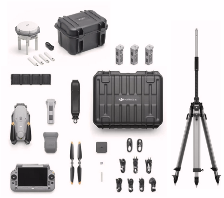
This is the full turnkey mapping setup. The DJI Matrice 4E aircraft, the D-RTK 3 base station, survey pole and tripod, four total flight batteries, and a 1-year DJI Terra license. You unbox it, set up your base station, and start producing survey-grade deliverables. No hunting down accessories, no compatibility guesswork.
Real people answer the phone at (863) 224-6923. No hold queue, no offshore call center.
What's In The Bundle
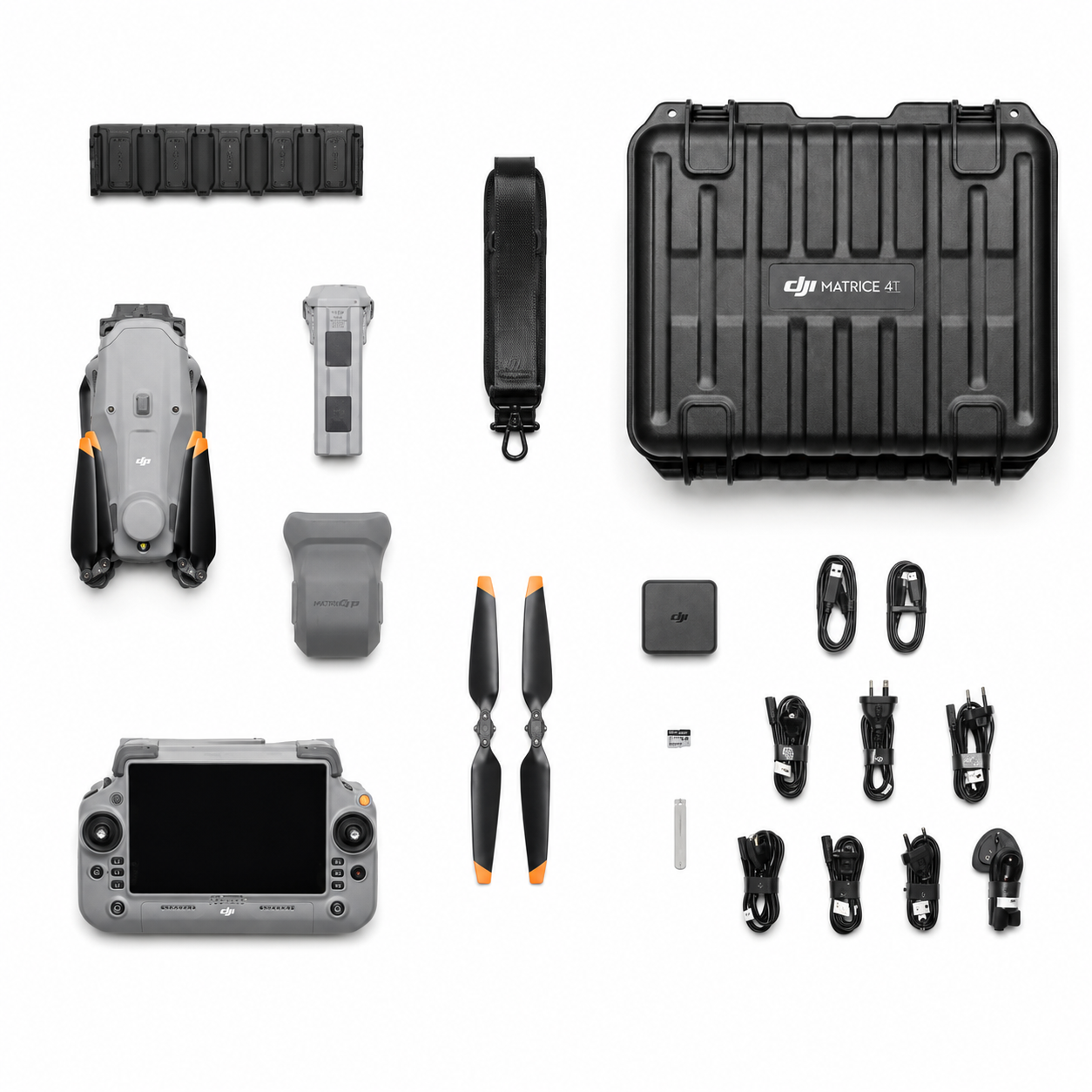
- DJI Matrice 4E with RC Plus 2 controller and accessories needed to fly (1-battery combo)
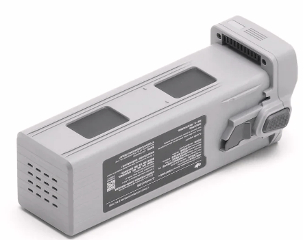
- 3 additional Matrice 4 Series Intelligent Flight Batteries (4 total, roughly 3 hours of mapping per charge cycle)
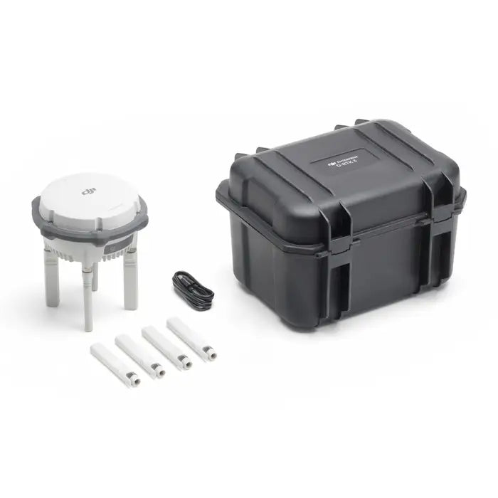
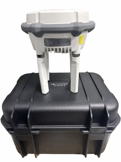
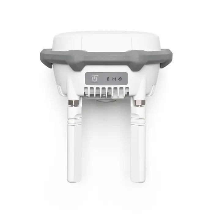
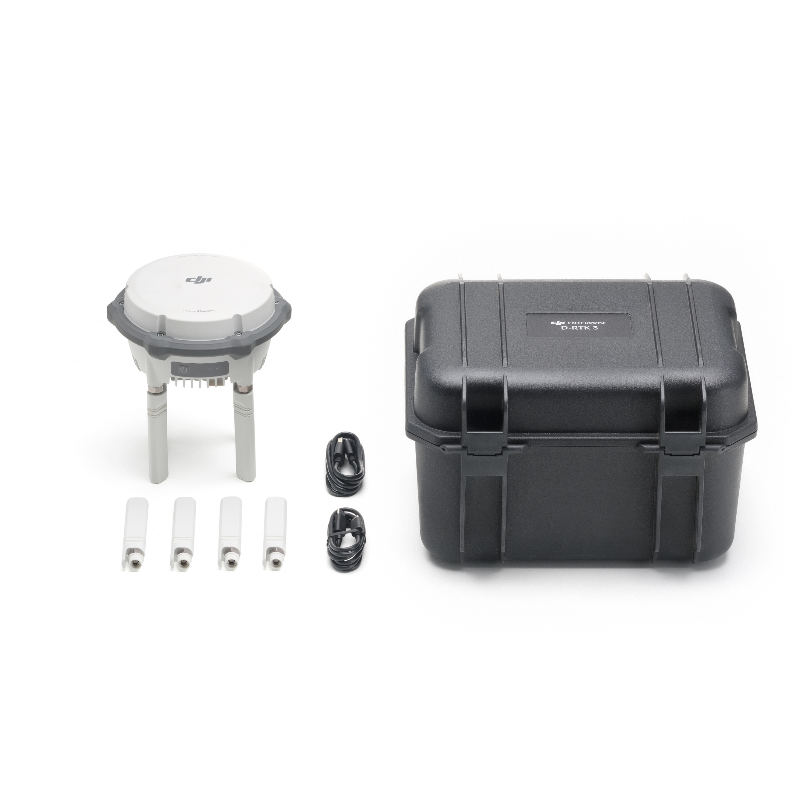
- DJI D-RTK 3 Base Station for centimeter-accurate corrections independent of cellular coverage
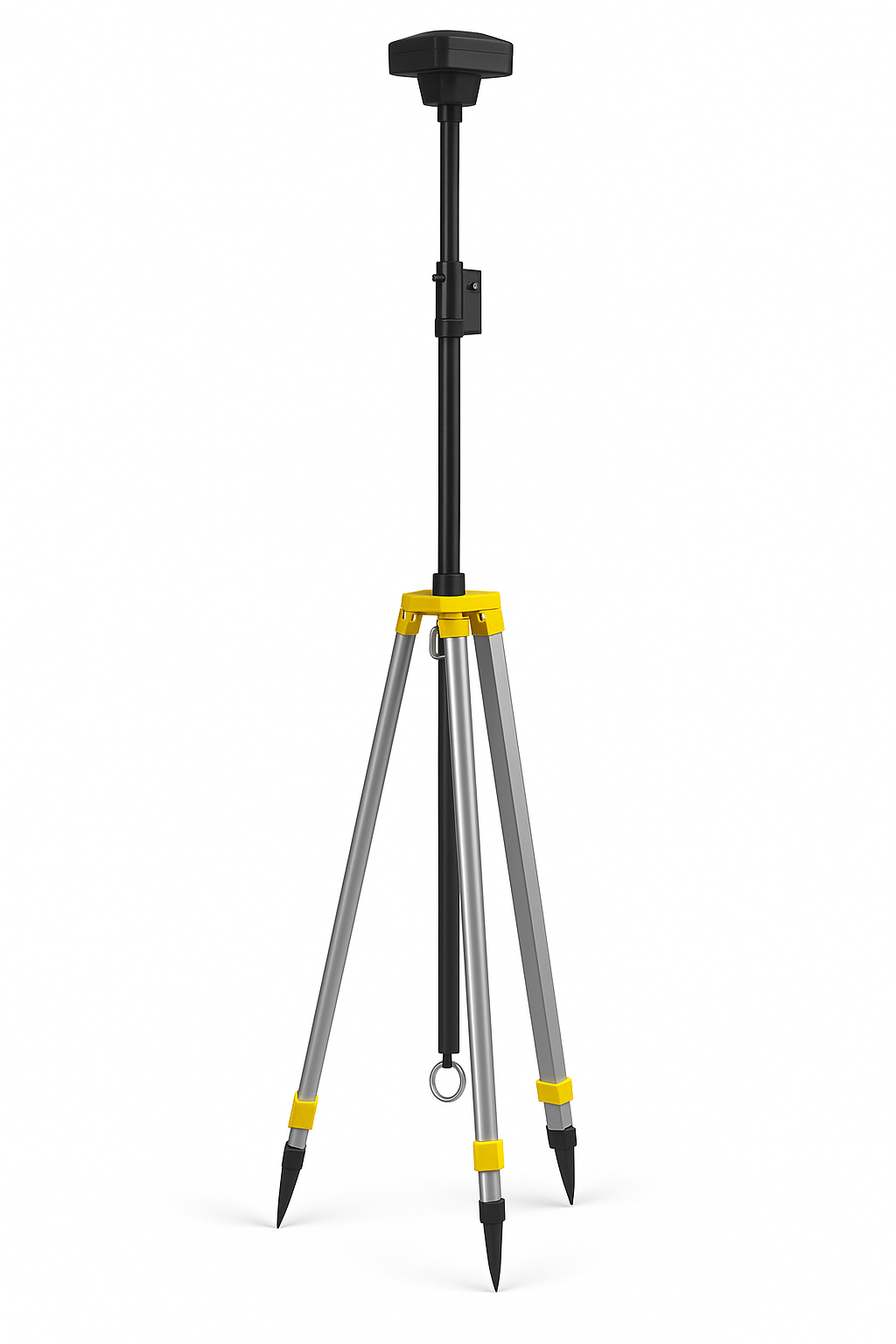
- RTK 3 Tripod & Survey Pole Kit for proper base station setup in the field
- 1-Year DJI Terra License included at no extra cost, a $1,680 value
DJI Terra Included at No Extra Cost (a $1,680 Value)
This bundle ships with a 1-year DJI Terra license included. That's the software that turns your flight data into orthomosaics, 3D models, and survey deliverables, and it normally runs $1,680 on its own. You're getting it at no additional charge.
One thing to know upfront. Terra has to be activated before your bundle ships, and that process adds time. Bundles with Terra included deliver in 10 to 14 business days instead of our standard 5 to 7. We'd rather tell you now than surprise you after checkout.
Quick Facts
- Built for: Licensed surveyors, civil engineers, construction operators, GIS professionals starting from scratch or standardizing a fleet
- Wide Camera: 4/3" CMOS with mechanical shutter, 20MP
- Total Cameras: 5 sensors (wide + medium telephoto + telephoto + laser rangefinder + AI detection)
- RTK: Integrated aircraft module plus included D-RTK 3 base station, also compatible with NTRIP and PPK workflows
- Mapping Speed: Up to 21 m/s with mechanical shutter
- Flight Time: Up to 49 minutes per battery, 4 batteries included
- Oblique Capture: 5-directional in a single pass
- Coverage: Up to 2.8 km² per flight at standard altitude
- Software: 1-year DJI Terra license included, a $1,680 value
- Delivery: 10 to 14 business days (Terra is activated before shipment)
- Protection: CPS Drone Protection available at checkout
Bundle or Standalone M4E?
The right choice depends on what you already have:
- Choose this bundle if you're building a survey operation from scratch, work in rural corridors or remote terrain without reliable cellular coverage, or want everything sourced and matched in one order.
- Choose the standalone M4E kit if you already own an RTK base station, run network RTK (NTRIP) in areas with solid coverage, or already have spare Matrice 4 Series batteries on hand.
Not sure which fits your operation? Call us at (863) 224-6923. We'll talk through your current setup before you commit.
Why the D-RTK 3 Base Station Matters
Network RTK works great until you're on a job site with no cellular signal. The D-RTK 3 broadcasts centimeter-accurate corrections directly to the aircraft, independent of any network. For rural corridor mapping, remote terrain, mine sites, and anywhere coverage is unreliable, the base station is the difference between consistent survey-grade accuracy and hoping your NTRIP connection holds.
The included tripod and survey pole kit means the base station gets set up properly over a known point, not balanced on a tailgate.
Why the Matrice 4E for Mapping
Mechanical Shutter
The single most important feature on the M4E for photogrammetry work is the mechanical shutter on the wide-angle camera. Electronic shutters expose each row of the sensor sequentially rather than capturing the entire frame simultaneously. At mapping speeds of 15 to 21 m/s, that sequential exposure creates geometric distortion across the image. Straight lines appear curved, buildings lean, and the orthomosaic requires significant correction work or produces measurable errors.
The M4E's mechanical shutter exposes all pixels simultaneously regardless of aircraft speed. The output is geometrically clean at full mapping speed, every frame, without post-processing compensation.
4/3-Inch CMOS Sensor
The wide-angle camera uses a 4/3-inch CMOS sensor, significantly larger than the 1/1.3-inch sensor in the M4T or sensors in consumer-grade mapping drones. A larger sensor collects more light per pixel, produces less noise at a given ISO, and resolves finer ground detail at the same altitude. You can fly higher and still hit ground sample distances that meet survey accuracy requirements, which means more coverage per battery.
5-Directional Oblique Capture in One Flight
The M4E's gimbal rotates intelligently during a single automated pass and captures nadir, forward-facing, backward-facing, left, and right oblique frames in one flight. Complete datasets for 3D building models, façade documentation, and terrain reconstruction without a second mobilization.
Factory Calibration Into Terra
Each M4E wide-angle camera is individually factory-calibrated, and those calibration parameters flow directly into the included DJI Terra license for reconstruction accuracy that exceeds generic photogrammetry pipelines. Residual distortion is calibrated to less than two pixels across the frame. The camera and the software in this bundle are built to work together.
Survey and Mapping Applications
- Topographic mapping and land surveys for engineering design, grading plans, contour mapping, and subdivision layout
- Construction site documentation with pre-construction base surveys, weekly progress orthomosaics, earthwork volumes, and final as-built documentation
- Stockpile volume surveys for quarry, aggregate, mining, and construction operations
- Corridor mapping for road, pipeline, and utility projects spanning multi-kilometer lengths
- 3D building and urban modeling for architectural documentation, BIM input data, and heritage preservation
- Environmental and wetland surveys for vegetation mapping, erosion monitoring, and flood plain topography
Shipping and Delivery
Delivery: 5 to 7 business days
Some units ship from U.S. inventory. Some ship direct from our supplier. Same delivery window either way.
If your order is delayed, we'll reach out. No silent backorders.
Tracking sent as soon as your unit ships.
Activation Status and Warranty
We're an independent reseller, not an authorized DJI Enterprise dealer.
What that means:
- Units are unused and unflown
- Zero flight time
- Activated prior to resale
- Bind to your DJI account at setup
- Same firmware, software, and functionality
What's different:
- Not eligible for DJI Enterprise Care
- Not covered under DJI U.S. warranty programs
DJI can still service them as paid repairs
Most of our customers run them with their liability insurance provider or add CPS protection coverage at checkout. More on that below.
Protection Coverage Options
CPS coverage is available at checkout.
What it covers:
- Operational issues
- Damage
- Repairs
What it isn't:
- DJI Care or manufacturer warranty
Why most customers add it:
- Real-world conditions
- Public safety, SAR, and recovery work
- Peace of mind at a similar price point
Add at checkout. Or call us and we'll talk through what makes sense for how you'll use it.
Net 30 and Agency Purchasing
Net 30 available for qualified buyers:
- Law enforcement agencies
- Fire departments
- Search and rescue teams
- Municipalities
We handle:
- Purchase orders
- Net 30 terms (with approval)
- W-9 and vendor onboarding
- Formal quotes for budget approval
- Grant-compatible documentation
Reach out before placing the order and we'll walk you through it.
Returns & Support
Real people answer the phone.
After your order you will receive:
- A confirmation email
- Tracking when it ships
- Help available before, during, and after setup
Returns:
- 30-day return period for unused, unflown and unopened products.
- Damaged on arrival? Call us