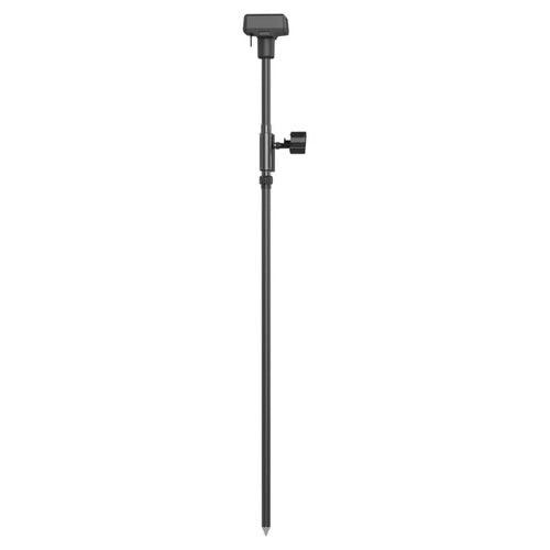
DJI D-RTK 2 High Precision GNSS Mobile Station
DJI D-RTK 2 High Precision GNSS Mobile Station
The DJI D-RTK 2 High Precision GNSS Mobile Station is an advanced, top-of-the-line geospatial data gathering tool, specifically engineered for use with DJI drone systems. This cutting-edge device is designed to provide centimeter-level positioning accuracy, enhancing the capabilities of aerial surveying and mapping applications.
Key features of the DJI D-RTK 2 include:
1. **Dual-Frequency GNSS Module:** It operates on GPS, GLONASS, Beidou, and GALILEO signals, offering high redundancy and reliability. The dual-frequency GNSS module significantly improves the accuracy of position data, especially in areas with poor signal reception like urban canyons.
2. **OcuSync Transmission Technology:** This feature ensures a stable, interference-resistant data transmission between the mobile station and the compatible DJI drone, even in challenging environments.
3. **Built-in High-gain Antenna:** The mobile station's high-gain antenna amplifies signal reception, which is critical in maintaining a stable connection and accurate data collection in various environments.
4. **Rugged Design:** It's built to endure harsh field conditions, with an IP67 rating ensuring dustproof and waterproof capabilities.
5. **Portability and Ease of Setup:** The mobile station is lightweight and compact, making it easy to transport and quick to set up, which is essential for professionals who require efficiency in the field.
6. **Compatibility with DJI Drones:** Designed to seamlessly integrate with various DJI drones, the D-RTK 2 is an essential component for professionals in industries like construction, agriculture, surveying, and mining, who rely on precise aerial mapping and data collection.
7. **RTK Network Support:** It can connect to a virtual reference station (VRS) network for even more accurate positioning data, making it ideal for tasks requiring the utmost precision.
The DJI D-RTK 2 High Precision GNSS Mobile Station represents a significant leap in drone-assisted surveying technology, offering unparalleled accuracy, reliability, and ease of use for professionals across a multitude of industries.